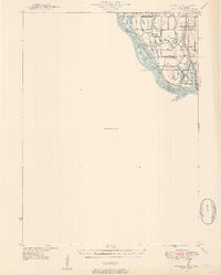
1946 Map of Wapello
USGS Topo · Published 1954About this map
The Mississippi River and the Iowa River converge in this mid-century survey, revealing a complex landscape of islands, sloughs, and managed waterways along the state border. At the center of the river activity is Lock and Dam No.17, a critical infrastructure point near Otter Island. The town of New Boston sits on the eastern shore, overlooking Boston Bay and the interconnected wetlands of Sturgeon Bay and Mill Slough.
Find a feature on this map
36 named features on this map. Tap any name to fly to it.
Don’t see what you’re looking for? This feature index may not catch every label — zoom into the map to look around manually.
Map Details
Editions of this 1946 Wapello Map
2 editions found
Other maps of this area

1916 · Edgington
USGS Topo · 1:62,500

1934 · Oquawka
USGS Topo · 1:48,000

1934 · Burlington
USGS Topo · 1:48,000

1935 · Keithsburg
USGS Topo · 1:48,000

1938 · Edgington
USGS Topo · 1:62,500

1940 · Oquawka
USGS Topo · 1:62,500

1940 · Burlington
USGS Topo · 1:62,500

1941 · Keithsburg
USGS Topo · 1:62,500

1946 · Wapello
USGS Topo · 1:62,500

1948 · Muscatine
USGS Topo · 1:62,500