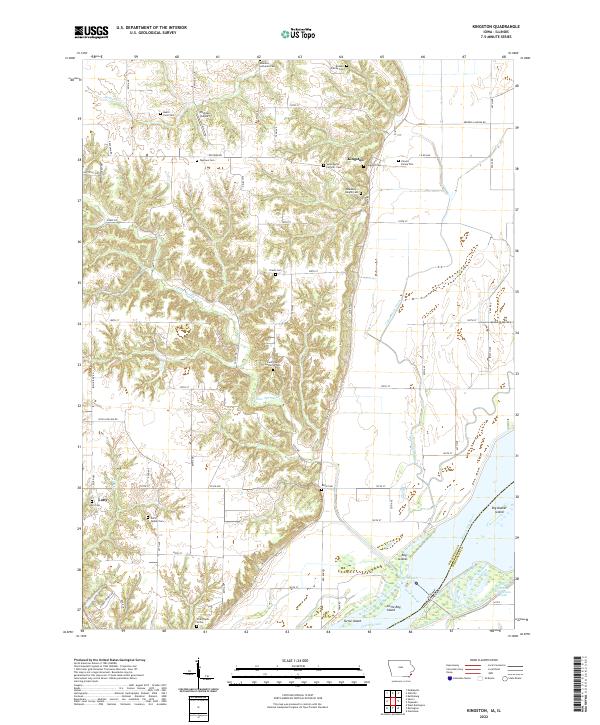
2022 Map of Kingston
USGS Topo · Published 2022About this map
Kingston sits on the bluffs overlooking the wide floodplains of the Mississippi River, where the landscape shifts from the rolling upland divides of Des Moines County to the intricate network of islands and sloughs along the Illinois border. This 2022 survey captures a rural environment defined by generations of land use, visible in the high density of small family burial grounds and churchyards such as the Driskell Family Cem, Hukill Farm Cem, and the Hinson Family Plot.
Find a feature on this map
77 named features on this map. Tap any name to fly to it.
Don’t see what you’re looking for? This feature index may not catch every label — zoom into the map to look around manually.
Map Details
Editions of this 2022 Kingston Map
This is the sole edition of this map. No revisions or reprints were ever made.
Other maps of this area

1934 · Oquawka
USGS Topo · 1:48,000

1934 · Burlington
USGS Topo · 1:48,000

1935 · Keithsburg
USGS Topo · 1:48,000

1940 · Oquawka
USGS Topo · 1:62,500

1940 · Burlington
USGS Topo · 1:62,500

1941 · Keithsburg
USGS Topo · 1:62,500

1946 · Wapello
USGS Topo · 1:62,500

1949 · Wapello
USGS Topo · 1:62,500

1958 · Burlington
USGS Topo · 1:250,000

1958 · Davenport
USGS Topo · 1:250,000