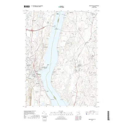
2019 Map of Kingston East
USGS Topo · Published 2019About this map
The Hudson River serves as the central artery for this Hudson Valley landscape, dividing the settlements of Kingston and Port Ewen in the west from Rhinebeck and Rhinecliff in the east. Modern infrastructure links these historic riverfront communities, most notably via the Kingston-Rhinecliff Bridge and the bridges spanning Rondout Creek, including the John T Loughran Bridge and the Kingston-Port Ewen Suspension Bridge. These crossings connect established neighborhoods like Sleightsburg, Ponck Hockie, and Connelly.
Find a feature on this map
61 named features on this map. Tap any name to fly to it.
Don’t see what you’re looking for? This feature index may not catch every label — zoom into the map to look around manually.
Map Details
Editions of this 2019 Kingston East Map
This is the sole edition of this map. No revisions or reprints were ever made.
Other maps of this area

1892 · Kaaterskill
USGS Topo · 1:62,500

1893 · Kaaterskill
USGS Topo · 1:62,500

1894 · Kaaterskill
USGS Topo · 1:62,500

1895 · Catskill
USGS Topo · 1:62,500

1898 · Rhinebeck
USGS Topo · 1:62,500

1899 · Kaaterskill
USGS Topo · 1:62,500

1901 · Rosendale
USGS Topo · 1:62,500

1903 · Rosendale
USGS Topo · 1:62,500

1903 · Kaaterskill
USGS Topo · 1:62,500

1934 · Rhinebeck
USGS Topo · 1:48,000