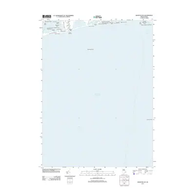
2012 Map of Kingston OE S
USGS Topo · Published 2012About this map
Green Hill sits along the northern edge of this coastal landscape, overlooking the intricate shoreline of Green Hill Pond. This 2012 survey documents a series of coastal barriers and salt ponds, where landforms like Gooseberry Island and Ram Island are separated from the Atlantic Ocean by narrow stretches of sand. The map reveals a high concentration of recreational and public access points along the surf, including Moonstone Beach, Roy Carpenters Beach, and the Deep Hole Public Fishing Area. Further east, the protected waters of Point Judith Harbor of Refuge provide a sheltered maritime environment. The coastal infrastructure is anchored by local routes such as Charlestown Beach Rd and Green Hill Beach Rd, illustrating the modern layout of these established summer communities and shoreline preserves.
Find a feature on this map
39 named features on this map. Tap any name to fly to it.
Don’t see what you’re looking for? This feature index may not catch every label — zoom into the map to look around manually.
Map Details
Editions of this 2012 Kingston OE S Map
This is the sole edition of this map. No revisions or reprints were ever made.
Other maps of this area

1889 · Charlestown
USGS Topo · 1:62,500

1889 · Newport
USGS Topo · 1:62,500

1889 · Block Island
USGS Topo · 1:62,500

1894 · Block Island
USGS Topo · 1:62,500

1894 · Newport
USGS Topo · 1:62,500

1899 · Block Island
USGS Topo · 1:62,500

1904 · Newport
USGS Topo · 1:62,500

1919 · Charlestown
USGS Topo · 1:62,500
1920 · Newport
USGS Topo · 1:62,500

1921 · Charlestown
USGS Topo · 1:62,500