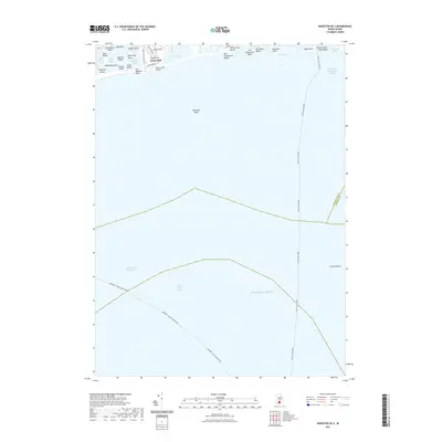
2021 Map of Kingston OE S
USGS Topo · Published 2021About this map
Green Hill serves as the primary coastal settlement on this map, situated between the tidal waters of Green Hill Pond and the open Atlantic Ocean. The shoreline is defined by a series of private and public waterfronts, including Roy Carpenters Beach, Willow Dell Beach, and Matunuck Beach, reflecting the long-standing seasonal and residential character of this Rhode Island stretch. Further east, the Point Judith Harbor of Refuge provides a protected maritime anchorage near Sand Hill Cove.
Find a feature on this map
38 named features on this map. Tap any name to fly to it.
Don’t see what you’re looking for? This feature index may not catch every label — zoom into the map to look around manually.
Map Details
Editions of this 2021 Kingston OE S Map
This is the sole edition of this map. No revisions or reprints were ever made.
Other maps of this area

1889 · Charlestown
USGS Topo · 1:62,500

1889 · Newport
USGS Topo · 1:62,500

1889 · Block Island
USGS Topo · 1:62,500

1894 · Block Island
USGS Topo · 1:62,500

1894 · Newport
USGS Topo · 1:62,500

1899 · Block Island
USGS Topo · 1:62,500

1904 · Newport
USGS Topo · 1:62,500

1919 · Charlestown
USGS Topo · 1:62,500
1920 · Newport
USGS Topo · 1:62,500

1921 · Charlestown
USGS Topo · 1:62,500