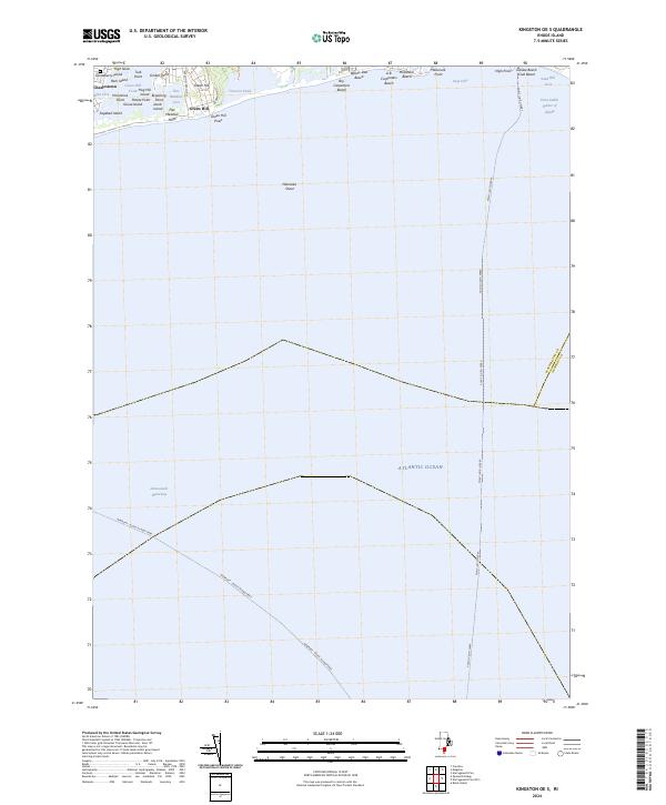
2024 Map of Kingston OE S
USGS Topo · Published 2024About this map
Trustom Pond National Wildlife Refuge dominates the coastline of this Rhode Island survey, preserving a critical barrier beach and coastal pond ecosystem. The landscape is defined by the complex interface of the Atlantic Ocean and tidal salt ponds, including Green Hill Pond and Trustom Pond. Along the shore, numerous family-named landmarks and beaches such as Roy Carpenters Beach, Willow Dell Beach, and A B Carpenters Beach reflect the region's long history as a summer destination. Near the settlement of Green Hill, the land is etched with small coves and points like Flat Meadow Point and Browning Point. Further offshore, the map traces vital maritime transit routes, including the Point Judith Ferry and the Newport - Block Island Ferry, which navigate past Nebraska Shoal and through the Intracoastal Waterway toward the Point Judith Harbor of Refuge.
Find a feature on this map
38 named features on this map. Tap any name to fly to it.
Don’t see what you’re looking for? This feature index may not catch every label — zoom into the map to look around manually.
Map Details
Editions of this 2024 Kingston OE S Map
This is the sole edition of this map. No revisions or reprints were ever made.
Other maps of this area

1889 · Charlestown
USGS Topo · 1:62,500

1889 · Newport
USGS Topo · 1:62,500

1889 · Block Island
USGS Topo · 1:62,500

1894 · Block Island
USGS Topo · 1:62,500

1894 · Newport
USGS Topo · 1:62,500

1899 · Block Island
USGS Topo · 1:62,500

1904 · Newport
USGS Topo · 1:62,500

1919 · Charlestown
USGS Topo · 1:62,500
1920 · Newport
USGS Topo · 1:62,500

1921 · Charlestown
USGS Topo · 1:62,500