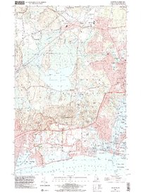
2024 Map of Kingston
USGS Topo · Published 2024About this map
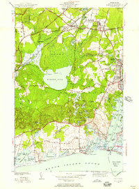
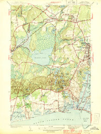
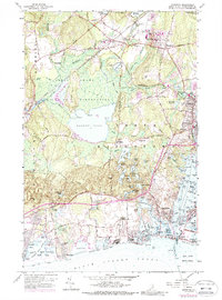
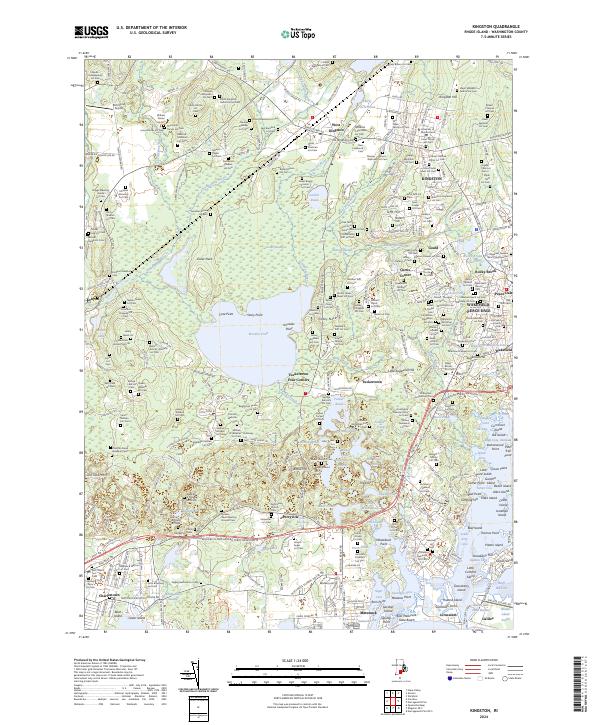
Kingston and its surrounding villages serve as the academic and civic anchor for this coastal region of Washington County. The sprawling campus of the University of Rhode Island and the nearby Court House emphasize the area's institutional importance, while the Amtrak corridor provides a modern link along historic rail alignments. The landscape is defined by its diverse water features, from the expansive Worden Pond and the Great Swamp to the industrial legacy visible at the Wakefield Mill Reservoir. Genealogy is a primary focus here, with an extraordinary density of family burial grounds such as the Gideon Clarke Lot Cem and George Gardiner Lot Cem, which reveal the deep ancestral roots of local families. Coastal settlements like Jerusalem and Galilee contrast with inland communities such as West Kingston and Gould, illustrating a century of growth from mill-based industry to a university-centered economy.
Find a feature on this map
289 named features on this map. Tap any name to fly to it.
Don’t see what you’re looking for? This feature index may not catch every label — zoom into the map to look around manually.
Map Details
Editions of this 2024 Kingston Map
This is the sole edition of this map. No revisions or reprints were ever made.
Historical Maps of Jerusalem Through Time
5 maps found