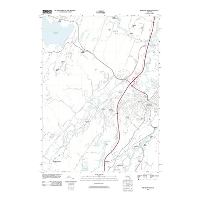
2010 Map of Kingston West
USGS Topo · Published 2010About this map
Esopus Creek winds through the heart of this landscape, carving a valley between the edge of the Ashokan Reservoir and the western reaches of Kingston. The area illustrates a diverse mix of land uses in the early 21st century, from the industrial presence of Boice Brothers Dairy to the recreational and youth facilities at Camp Vacamas near the Twin Lakes. Residential and historic nodes like Hurley and Bloomington are set against a backdrop of prominent local elevations such as Jockey Hill and Gallis Hill.
Find a feature on this map
97 named features on this map. Tap any name to fly to it.
Don’t see what you’re looking for? This feature index may not catch every label — zoom into the map to look around manually.
Map Details
Editions of this 2010 Kingston West Map
This is the sole edition of this map. No revisions or reprints were ever made.
Other maps of this area

1892 · Kaaterskill
USGS Topo · 1:62,500

1893 · Kaaterskill
USGS Topo · 1:62,500

1894 · Kaaterskill
USGS Topo · 1:62,500

1895 · Catskill
USGS Topo · 1:62,500

1898 · Rhinebeck
USGS Topo · 1:62,500

1899 · Kaaterskill
USGS Topo · 1:62,500

1901 · Rosendale
USGS Topo · 1:62,500

1903 · Rosendale
USGS Topo · 1:62,500

1903 · Kaaterskill
USGS Topo · 1:62,500

1934 · Rhinebeck
USGS Topo · 1:48,000