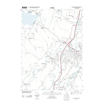
2013 Map of Kingston West
USGS Topo · Published 2013About this map
Hurley and the surrounding Ulster County countryside appear here in a period of modern suburban continuity and established agricultural land. The map showcases a landscape defined by its complex water systems, from the eastern edge of the Ashokan Reservoir and Onteora Lake to the winding course of Esopus Cr. Local industry and land use are noted through specific landmarks like Boice Brothers Dairy, Gill Corn Farms, and Buzzanco's Greenhouses And Farm, illustrating the persistent agricultural character of the region even near the city periphery.
Find a feature on this map
252 named features on this map. Tap any name to fly to it.
Don’t see what you’re looking for? This feature index may not catch every label — zoom into the map to look around manually.
Map Details
Editions of this 2013 Kingston West Map
This is the sole edition of this map. No revisions or reprints were ever made.
Other maps of this area

1892 · Kaaterskill
USGS Topo · 1:62,500

1893 · Kaaterskill
USGS Topo · 1:62,500

1894 · Kaaterskill
USGS Topo · 1:62,500

1895 · Catskill
USGS Topo · 1:62,500

1898 · Rhinebeck
USGS Topo · 1:62,500

1899 · Kaaterskill
USGS Topo · 1:62,500

1901 · Rosendale
USGS Topo · 1:62,500

1903 · Rosendale
USGS Topo · 1:62,500

1903 · Kaaterskill
USGS Topo · 1:62,500

1934 · Rhinebeck
USGS Topo · 1:48,000