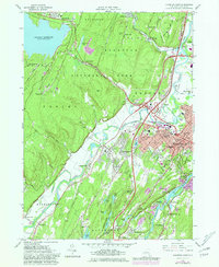
1980 Map of Kingston West
USGS Topo · Published 1981About this map
Kingston and its surrounding villages sit at a historic convergence of river, rail, and valley roads during the late twentieth century. This 1980 photorevision captures the urban layout of the city alongside the New York State Thruway and the Conrail lines, while documenting the sprawling institutional and spiritual landscape of the area. Significant local heritage is preserved through the mapping of the Old Dutch Ch Cem, Wiltwyck Cemetery, and St Peters Cem.
Find a feature on this map
94 named features on this map. Tap any name to fly to it.
Don’t see what you’re looking for? This feature index may not catch every label — zoom into the map to look around manually.
Map Details
Editions of this 1980 Kingston West Map
This is the sole edition of this map. No revisions or reprints were ever made.
Other maps of this area

1892 · Kaaterskill
USGS Topo · 1:62,500

1893 · Kaaterskill
USGS Topo · 1:62,500

1894 · Kaaterskill
USGS Topo · 1:62,500

1895 · Catskill
USGS Topo · 1:62,500

1898 · Rhinebeck
USGS Topo · 1:62,500

1899 · Kaaterskill
USGS Topo · 1:62,500

1901 · Rosendale
USGS Topo · 1:62,500

1903 · Rosendale
USGS Topo · 1:62,500

1903 · Kaaterskill
USGS Topo · 1:62,500

1934 · Rhinebeck
USGS Topo · 1:48,000