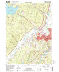
1997 Map of Kingston West
USGS Topo · Published 2000About this map
Kingston serves as the focal point of this Ulster County landscape, where the urban grid meets the rugged eastern edge of the Catskill Park. The map documents a complex interface of water management and transportation, dominated by the massive Ashokan Reservoir and its spillway to the west. Between the city and the reservoir, the ancient course of the Esopus Creek winds through the valley, passing the historic settlement of Hurley and the recreational grounds of Forsyth Park.
Find a feature on this map
97 named features on this map. Tap any name to fly to it.
Don’t see what you’re looking for? This feature index may not catch every label — zoom into the map to look around manually.
Map Details
Editions of this 1997 Kingston West Map
This is the sole edition of this map. No revisions or reprints were ever made.
Other maps of this area

1892 · Kaaterskill
USGS Topo · 1:62,500

1893 · Kaaterskill
USGS Topo · 1:62,500

1894 · Kaaterskill
USGS Topo · 1:62,500

1895 · Catskill
USGS Topo · 1:62,500

1898 · Rhinebeck
USGS Topo · 1:62,500

1899 · Kaaterskill
USGS Topo · 1:62,500

1901 · Rosendale
USGS Topo · 1:62,500

1903 · Rosendale
USGS Topo · 1:62,500

1903 · Kaaterskill
USGS Topo · 1:62,500

1934 · Rhinebeck
USGS Topo · 1:48,000