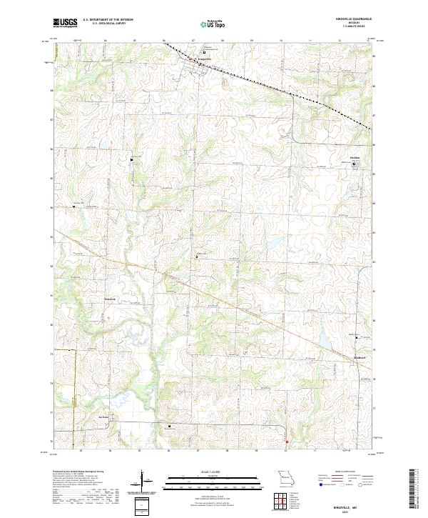
2021 Map of Kingsville
USGS Topo · Published 2021About this map
Kingsville and Holden anchor this portion of the Missouri landscape, where the headwaters of numerous creeks diverge across the prairie. The topography is defined by the subtle drainage basins of Big Cr, Lost Creek, and the many branches of West Pin Oak Creek. These watercourses dictated the early settlement patterns and road networks that still crisscross the region today.
Find a feature on this map
63 named features on this map. Tap any name to fly to it.
Don’t see what you’re looking for? This feature index may not catch every label — zoom into the map to look around manually.
Map Details
Editions of this 2021 Kingsville Map
This is the sole edition of this map. No revisions or reprints were ever made.
Other maps of this area

1885 · Warrensburg
USGS Topo · 1:125,000

1887 · Harrisonville
USGS Topo · 1:125,000

1887 · Warrensburg
USGS Topo · 1:125,000

1892 · Harrisonville
USGS Topo · 1:125,000

1894 · Harrisonville
USGS Topo · 1:125,000

1894 · Warrensburg
USGS Topo · 1:125,000

1947 · Jefferson City
USGS Topo · 1:250,000

1947 · Lawrence
USGS Topo · 1:250,000

1950 · Lawrence
USGS Topo · 1:250,000

1954 · Jefferson City
USGS Topo · 1:250,000