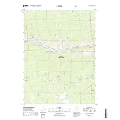
2019 Map of Kinikinik
USGS Topo · Published 2019About this map
Kinikinik and Idylwilde sit along the winding corridor of the Cache la Poudre River, which is designated here as the Cache La Poudre Wild and Scenic River. This high-altitude landscape in the Roosevelt National Forest is defined by sharp elevation changes, climbing from the riverbanks toward the peaks of the Mummy Range. Genealogists and local historians can find specific markers of the area's human history, such as the Charles E. Williams Grave near Roaring Creek and the Campbell Cem. The map traces numerous forest access routes, including Crown Point road and the Crown Point Overlook, which provide vantage points over Black Hollow and the Cheyenne Ridge. To the south, the terrain culminates near Browns Lake, while landmarks like Profile Rock near the eastern edge highlight the distinct geological character of the canyon.
Find a feature on this map
84 named features on this map. Tap any name to fly to it.
Don’t see what you’re looking for? This feature index may not catch every label — zoom into the map to look around manually.
Map Details
Editions of this 2019 Kinikinik Map
This is the sole edition of this map. No revisions or reprints were ever made.
Other maps of this area

1916 · Home
USGS Topo · 1:125,000

1920 · Home
USGS Topo · 1:125,000

1954 · Greeley
USGS Topo · 1:250,000

1957 · Greeley
USGS Topo · 1:250,000

1958 · Greeley
USGS Topo · 1:250,000

1961 · Greeley
USGS Topo · 1:250,000
1962 · Pingree Park
USGS Topo · 1:24,000

1962 · Boston Peak
USGS Topo · 1:24,000
1962 · Comanche Peak
USGS Topo · 1:24,000

1962 · Kinikinik
USGS Topo · 1:24,000