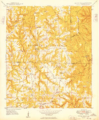
1949 Map of Kinlock Spring
USGS Topo · Published 1949About this map
William B Bankhead National Forest covers much of this mid-century landscape where the Tennessee Valley Divide snakes through northwestern Alabama. The area is defined by its rural density, featuring a network of country churches like St Paul Ch and Maxwell Chapel, and localized family-named settlements including Martintown and Posey Mill. The presence of the CCC Camp 931 (Abandoned) and the Kinlock Lookout Tower points to the era's focus on forest management and conservation.
Find a feature on this map
62 named features on this map. Tap any name to fly to it.
Don’t see what you’re looking for? This feature index may not catch every label — zoom into the map to look around manually.
Map Details
Editions of this 1949 Kinlock Spring Map
This is the sole edition of this map. No revisions or reprints were ever made.
Other maps of this area

1936 · Newburg
USGS Topo · 1:24,000

1936 · Delmar
USGS Topo · 1:24,000

1936 · Kinlock Spring
USGS Topo · 1:24,000

1936 · Phil Campbell
USGS Topo · 1:24,000

1936 · Moulton
USGS Topo · 1:48,000

1936 · Spruce Pine
USGS Topo · 1:24,000

1936 · Goddard
USGS Topo · 1:24,000

1936 · Landersville
USGS Topo · 1:24,000

1940 · Mt Hope
USGS Topo · 1:62,500

1945 · Spruce Pine
USGS Topo · 1:24,000