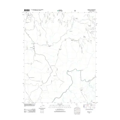
2012 Map of Kinsley
USGS Topo · Published 2012About this map
Tuolumne River and the Merced River define the hydraulic character of this Mariposa County landscape, where the Sierra foothills are etched by numerous drainages like Lewis Gulch and Miller Gulch. Historically significant routes like Old Yosemite Rd and Ponderosa Way trace the terrain, connecting isolated ranching outposts such as McCauley Ranch and Jenkins Ranch. The map reveals a land structured by ridges and flats, from the heights of Big Grizzly Mountain down to Big Grizzly Flat. This survey captures the region's transition from traditional ranching and timber activity to modern land management, indicated by the extensive network of Forest Service routes including Forest Rte 2S02 and Forest Rte 3S01. The lower elevations near the South Fork and S Fork Merced River show the convergence of waterway and road near Incline Rd.
Find a feature on this map
42 named features on this map. Tap any name to fly to it.
Don’t see what you’re looking for? This feature index may not catch every label — zoom into the map to look around manually.
Map Details
Editions of this 2012 Kinsley Map
This is the sole edition of this map. No revisions or reprints were ever made.
Other maps of this area

1893 · Sonora
USGS Topo · 1:125,000

1896 · Sonora
USGS Topo · 1:125,000

1897 · Sonora
USGS Topo · 1:125,000

1897 · Yosemite
USGS Topo · 1:125,000

1898 · Sonora
USGS Topo · 1:125,000

1900 · Yosemite
USGS Topo · 1:125,000

1903 · Yosemite
USGS Topo · 1:125,000

1909 · Yosemite
USGS Topo · 1:125,000

1947 · El Portal
USGS Topo · 1:24,000

1947 · San Jose
USGS Topo · 1:250,000