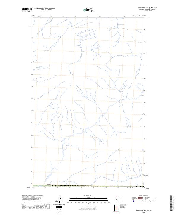
2024 Map of Kintla Lake OE N
USGS Topo · Published 2024About this map
Kishinena Creek defines the primary drainage of this northern Flathead County landscape, winding through a complex network of tributaries just below the international boundary with Canada. The area is characterized by a dense system of alpine waterways, including the headwaters of Ruby Creek and the southern reaches of Langemarck Brook. This 2024 survey captures the untouched character of the high country, where named features such as Nettie Creek and Starvation Creek indicate a geography shaped entirely by its hydrology. The convergence of these waters near the northern border suggests a critical watershed connection within the transboundary ecosystem of the Rocky Mountains.
Find a feature on this map
6 named features on this map. Tap any name to fly to it.
Don’t see what you’re looking for? This feature index may not catch every label — zoom into the map to look around manually.
Map Details
Editions of this 2024 Kintla Lake OE N Map
This is the sole edition of this map. No revisions or reprints were ever made.
Other maps of this area

1906 · Kintla Lakes
USGS Topo · 1:125,000

1938 · Kintla Lakes
USGS Topo · 1:125,000

1957 · Kalispell
USGS Topo · 1:250,000

1960 · Kalispell
USGS Topo · 1:250,000

1961 · Kalispell
USGS Topo · 1:250,000

1966 · Kintla Lake
USGS Topo · 1:24,000
1966 · Trailcreek
USGS Topo · 1:24,000
1968 · Kintla Peak
USGS Topo · 1:24,000
1981 · Whitefish Range
USGS Topo · 1:100,000
1994 · Trailcreek
USGS Topo · 1:24,000