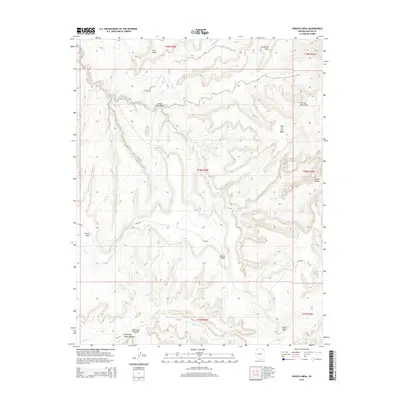
2014 Map of Kinusta Mesa
USGS Topo · Published 2014About this map
Kinusta Mesa and the surrounding high plateaus of the Shiprock Agency define this high-elevation landscape in the northeastern corner of Arizona. The topography is dominated by an intricate network of deep canyons and massive tablelands, including Altar Mesa, Sunnyside Mesa, and the isolated Segi Ho Cho Mesa near the Carrizo Mountains. Hydrological patterns are etched into the stone, where Walker Creek and its tributaries carve their way through Alcove Canyon and past the expansive Alcove Mesa. To the south, drainage is captured by Hasbidito Cr as it flows below Cove Mesa. The map illustrates a landscape of limited accessibility, primarily reached via routes like Bia-5040 and Bia-172. Evocative local names such as Splashing Water Canyon and Bear Trail Canyon suggest a terrain where seasonal water and animal paths have long guided movement through the complex canyon systems.
Find a feature on this map
23 named features on this map. Tap any name to fly to it.
Don’t see what you’re looking for? This feature index may not catch every label — zoom into the map to look around manually.
Map Details
Editions of this 2014 Kinusta Mesa Map
This is the sole edition of this map. No revisions or reprints were ever made.
Other maps of this area

1892 · Canyon De Chelly
USGS Topo · 1:250,000

1953 · Los Gigantes NE
USGS Topo · 1:24,000

1953 · Los Gigantes NW
USGS Topo · 1:24,000

1953 · Pastora Peak SW
USGS Topo · 1:24,000

1953 · Redrock Valley SW
USGS Topo · 1:24,000

1953 · Los Gigantes SE
USGS Topo · 1:24,000

1953 · Dinne Mesa SW
USGS Topo · 1:24,000

1953 · Los Gigantes SW
USGS Topo · 1:24,000

1953 · Redrock Valley NW
USGS Topo · 1:24,000

1953 · Dinne Mesa SE
USGS Topo · 1:24,000