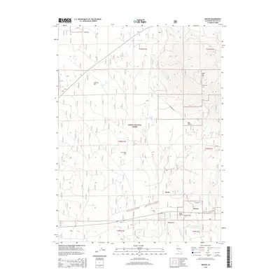
2015 Map of Kinyon
USGS Topo · Published 2015About this map
Kinyon and Swobe anchor the southeastern corner of this landscape within the Shasta National Forest. The geography is defined by a series of high-altitude flats and sinks where drainage patterns fluctuate with the seasons. Notable among these is the Ash Creek Sink, which collects the waters of Ash Cr as it flows south toward the McCloud River. To the northeast, the terrain rises toward Black Fox Mtn, overlooking a series of meadows and drainages including Bear Wallow and Elk Flat. The map reveals a sophisticated network of forest management roads and firebreaks, such as E Firebreak, cutting through the timbered sections between Skunk Hollow and Fourmile Flat. This era of the forest's history is marked by a blend of old rail-era settlements and modern conservation infrastructure, tracing the transition from early industrial extraction to managed wilderness.
Find a feature on this map
27 named features on this map. Tap any name to fly to it.
Don’t see what you’re looking for? This feature index may not catch every label — zoom into the map to look around manually.
Map Details
Editions of this 2015 Kinyon Map
This is the sole edition of this map. No revisions or reprints were ever made.
Other maps of this area

1886 · Modoc Lava Bed
USGS Topo · 1:250,000

1886 · Shasta
USGS Topo · 1:250,000

1892 · Modoc Lava-Bed
USGS Topo · 1:250,000

1894 · Shasta
USGS Topo · 1:250,000

1932 · Bartle
USGS Topo · 1:96,000

1935 · Dunsmuir
USGS Topo · 1:125,000

1939 · Bartle
USGS Topo · 1:125,000

1948 · Weed
USGS Topo · 1:250,000

1950 · Weed
USGS Topo · 1:250,000

1954 · Shoeinhorse Mountain
USGS Topo · 1:62,500