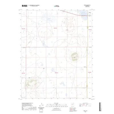
2023 Map of Kiowa
USGS Topo · Published 2023About this map
Horseshoe Crater and Melon Mesa define the volcanic high plains of northeastern New Mexico, where the Colfax and Union county lines meet. The small settlement of Kiowa sits at the foot of Kiowa Mesa, a prominent landform overlooking the expansive Kiowa Flats. This high-altitude landscape is dotted with seasonal water sources and named springs, including Kiowa Springs and the aptly named Lakeside Lake. Near the northern border, the village of Capulin provides a point of entry into this ranching country, while the Mountain View Cem serves as a local genealogical landmark. The network of roads, such as Wrangler Rd and Co Rd A 18, reveals the modern rural infrastructure used to navigate between these ancient geological features, including Farr Vega Lake and Cassan Lake.
Find a feature on this map
26 named features on this map. Tap any name to fly to it.
Don’t see what you’re looking for? This feature index may not catch every label — zoom into the map to look around manually.
Map Details
Editions of this 2023 Kiowa Map
This is the sole edition of this map. No revisions or reprints were ever made.
Other maps of this area

1954 · Raton
USGS Topo · 1:250,000

1954 · Dalhart
USGS Topo · 1:250,000

1958 · Raton
USGS Topo · 1:250,000

1958 · Dalhart
USGS Topo · 1:250,000

1962 · Dalhart
USGS Topo · 1:250,000

1971 · Kiowa
USGS Topo · 1:24,000

1971 · Robinson Peak
USGS Topo · 1:24,000

1971 · Johnson Park
USGS Topo · 1:24,000

1971 · Pine Buttes
USGS Topo · 1:24,000

1971 · Palo Blanco Mountain
USGS Topo · 1:24,000