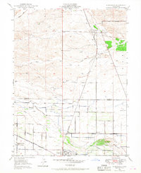
1949 Map of Kirkwood
USGS Topo · Published 1968About this map
The agricultural and transit corridor along the Tehama and Glenn county line is anchored by the Southern Pacific railroad, which runs north-south through the settlements of Kirkwood and Orland. This 1949 survey illustrates an intricate water management system essential to the Central Valley's productivity, featuring the Stony Creek Irrigation Canal, Lemon Home Canal, and Colony Canal. These waterways divert from Stony Creek to support the surrounding orchards and fields. Local community life is evidenced by several rural educational and religious sites, including the Calumet Sch, Lake School, and the Seventh-day Adventist School. The map also captures aviation infrastructure of the era, such as an Airway Beacon and the Orland Auxiliary Airport No 2, while legacy land divisions are preserved through the Capay Grant Boundary.
Find a feature on this map
33 named features on this map. Tap any name to fly to it.
Don’t see what you’re looking for? This feature index may not catch every label — zoom into the map to look around manually.
Map Details
Editions of this 1949 Kirkwood Map
3 editions found
Other maps of this area

1904 · Vina
USGS Topo · 1:62,500

1904 · Walker Creek
USGS Topo · 1:31,680

1906 · Willows
USGS Topo · 1:62,500

1914 · Kirkwood
USGS Topo · 1:31,680

1914 · Orland
USGS Topo · 1:31,680

1914 · Hamilton
USGS Topo · 1:31,680

1914 · McIntosh Landing
USGS Topo · 1:31,680

1919 · Fruto
USGS Topo · 1:62,500

1944 · Fruto
USGS Topo · 1:62,500

1944 · Flournoy
USGS Topo · 1:62,500