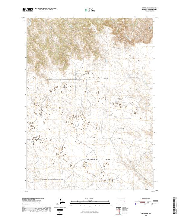
2021 Map of Kirtley SW
USGS Topo · Published 2021About this map
Niobrara County's high plains terrain is defined by a dendritic network of ephemeral drainages and intermittent streams in this modern 2021 survey. The landscape is carved by watercourses including Middle Creek, Fitzsimmons Creek, and Indian Creek, which flow through the sectioned ranch lands of the high Wyoming prairie. Settlement in this portion of the county remains sparse, oriented around the path of Kirtley Rd as it traverses the central townships. The map provides a precise contemporary look at the Public Land Survey System, illustrating the grid of T33N R61W and T34N R61W. This area is characterized by rolling topography and prominent draws such as S Bar Rd Draw and the headwaters of Van Tassell Creek, reflecting a region dedicated to large-scale livestock grazing and open-range land management.
Find a feature on this map
11 named features on this map. Tap any name to fly to it.
Don’t see what you’re looking for? This feature index may not catch every label — zoom into the map to look around manually.
Map Details
Editions of this 2021 Kirtley SW Map
This is the sole edition of this map. No revisions or reprints were ever made.
Other maps of this area

1954 · Torrington
USGS Topo · 1:250,000

1958 · Torrington
USGS Topo · 1:250,000

1974 · Mc Master Reservoir
USGS Topo · 1:24,000

1977 · Van Tassell
USGS Topo · 1:24,000
1978 · Node
USGS Topo · 1:24,000

1978 · Shepherds Point
USGS Topo · 1:24,000

1978 · Kirtley SW
USGS Topo · 1:24,000
1978 · Sherrill Hills
USGS Topo · 1:24,000

1978 · Kirtley
USGS Topo · 1:24,000
1981 · Signature Rock
USGS Topo · 1:24,000