
1974 Map of Mc Master Reservoir
USGS Topo · Published 1977About this map
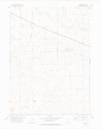
The Niobrara River carves a winding path across this portion of Niobrara County, creating a valley that dictates the local infrastructure of the mid-1970s. Running parallel to the river's northern banks, the Chicago and North Western railroad provides a clear east-west corridor through the high plains landscape. This proximity of rail and water defines the land use in the quadrangle, where the McMaster Reservoir serves as a critical water feature for the surrounding area. Beyond the river valley, the terrain is dotted with signs of local industry and resource extraction, including several noted wells and a drill hole, suggesting active exploration or maintenance of water and mineral rights during this era. The presence of Duck Creek further illustrates the drainage patterns that have historically shaped this Wyoming ranching country.
Find a feature on this map
7 named features on this map. Tap any name to fly to it.
Don’t see what you’re looking for? This feature index may not catch every label — zoom into the map to look around manually.
Map Details
Editions of this 1974 Mc Master Reservoir Map
This is the sole edition of this map. No revisions or reprints were ever made.
Other maps of this area

1954 · Torrington
USGS Topo · 1:250,000

1958 · Torrington
USGS Topo · 1:250,000

1977 · Hileman Draw
USGS Topo · 1:24,000

1977 · Van Tassell
USGS Topo · 1:24,000

1977 · Van Tassell SE
USGS Topo · 1:24,000

1977 · Prairie Center
USGS Topo · 1:24,000
1978 · Node
USGS Topo · 1:24,000

1978 · Kirtley SW
USGS Topo · 1:24,000

1978 · Kirtley
USGS Topo · 1:24,000
1981 · Signature Rock
USGS Topo · 1:24,000