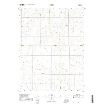
2018 Map of Kirwin SE
USGS Topo · Published 2018About this map
Medicine Cr winds through the rolling landscape of north-central Kansas, cutting through the intersection of four counties. The terrain is defined by its rural grid of section lines and gravel roads, such as Co Line RD and E Big Bear RD, which serve a territory largely dedicated to agriculture. Several early community anchors are documented here, primarily through their enduring burial grounds. Local heritage is preserved at sites like Bohemian Cem and Pleasant Ridge Cem, providing valuable physical markers for genealogists researching the area's pioneer families. The presence of Ash Rock Cem and Spring Branch Cem further south suggests the historical locations of early prairie settlements and rural congregations that once dotted this landscape along the banks of Crooked Cr.
Find a feature on this map
40 named features on this map. Tap any name to fly to it.
Don’t see what you’re looking for? This feature index may not catch every label — zoom into the map to look around manually.
Map Details
Editions of this 2018 Kirwin SE Map
This is the sole edition of this map. No revisions or reprints were ever made.
Other maps of this area

1893 · Smith Center
USGS Topo · 1:125,000

1893 · Phillipsburg
USGS Topo · 1:125,000

1896 · Osborne
USGS Topo · 1:125,000

1896 · Plainville
USGS Topo · 1:125,000

1953 · Woodston NW
USGS Topo · 1:24,000

1953 · Woodston
USGS Topo · 1:24,000

1953 · Alton
USGS Topo · 1:24,000

1955 · Beloit
USGS Topo · 1:250,000

1959 · Beloit
USGS Topo · 1:250,000

1961 · Kirwin SE
USGS Topo · 1:24,000