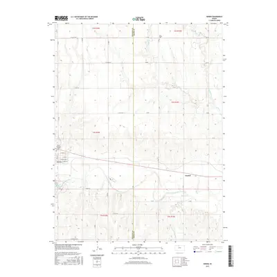
2015 Map of Kirwin
USGS Topo · Published 2015About this map
The Kirwin townsite sits at a significant bend of the N Fork Solomon River, where the prairie landscape meets the rising waters of the Kirwin Reservoir. This 2015 survey illustrates a rural crossroads economy defined by the intersection of alphabetical and numerical range roads that segment the territory between the Phillips Co and Smith Co boundary. Evidence of early settlement patterns remains visible at the Olive Branch Cem in the north and the small community of Claudell further east. The local infrastructure supports both agriculture and aviation, highlighted by the Wyrill Farming Airport. Hydrological features like Medicine Cr and Middle Cedar Cr carve through the terrain, feeding into the river system that has historically sustained these Kansas communities.
Find a feature on this map
45 named features on this map. Tap any name to fly to it.
Don’t see what you’re looking for? This feature index may not catch every label — zoom into the map to look around manually.
Map Details
Editions of this 2015 Kirwin Map
This is the sole edition of this map. No revisions or reprints were ever made.
Other maps of this area

1893 · Smith Center
USGS Topo · 1:125,000

1893 · Phillipsburg
USGS Topo · 1:125,000

1955 · Beloit
USGS Topo · 1:250,000

1959 · Beloit
USGS Topo · 1:250,000

1961 · Kirwin SE
USGS Topo · 1:24,000

1961 · Gaylord SW
USGS Topo · 1:24,000

1961 · Kirwin SW
USGS Topo · 1:24,000

1972 · Kirwin
USGS Topo · 1:24,000

1972 · Kirwin Reservoir
USGS Topo · 1:24,000

1973 · Kensington
USGS Topo · 1:24,000