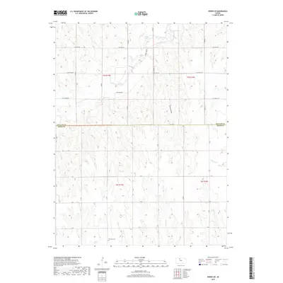
2018 Map of Kirwin SW
USGS Topo · Published 2018About this map
The Phillips Co Rooks Co border divides this 2018 survey, which shows a landscape defined by the drainage networks of the Smoky Hills region. In the northern section, Bow Cr winds through the hills, while further south, the headwaters of Jim Cr, E Br Jim Cr, and Buras Cr carve narrow valleys into the terrain. The agricultural grid is punctuated by local identifiers like West Hope Cem in the southwestern corner, a quiet landmark for genealogical research in this rural expanse. Near the northern edge, Catfish Cove indicates the proximity of the Kirwin Reservoir area, though the map largely focuses on the undulating plains and hollows, such as the notably named Hungry Hollow and Douglas Cr. The survey preserves the local road names of the era, from the descriptively named E Day Dream Rd to the utilitarian Co Line Rd.
Find a feature on this map
34 named features on this map. Tap any name to fly to it.
Don’t see what you’re looking for? This feature index may not catch every label — zoom into the map to look around manually.
Map Details
Editions of this 2018 Kirwin SW Map
This is the sole edition of this map. No revisions or reprints were ever made.
Other maps of this area

1893 · Phillipsburg
USGS Topo · 1:125,000

1896 · Plainville
USGS Topo · 1:125,000

1953 · Woodston NW
USGS Topo · 1:24,000

1953 · Stockton
USGS Topo · 1:24,000

1953 · Woodston
USGS Topo · 1:24,000

1955 · Beloit
USGS Topo · 1:250,000

1959 · Beloit
USGS Topo · 1:250,000

1961 · Kirwin SE
USGS Topo · 1:24,000

1961 · Kirwin SW
USGS Topo · 1:24,000

1972 · Kirwin
USGS Topo · 1:24,000