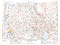
1958 Map of Klamath Falls
USGS Topo · Published 1958About this map
Klamath Falls and the sprawling Klamath Indian Reservation anchor this mid-century survey of the Oregon-California borderlands. The landscape is defined by its massive water systems, from the expansive Upper Klamath Lake and Agency Lake in the west to the terminal basins of Summer Lake and Lake Abert further east. The mid-1950s infrastructure reflects a region built on timber and transport, with the Southern Pacific, Great Northern, and Oregon California and Eastern railroads threading through the high desert and mountains.
Find a feature on this map
72 named features on this map. Tap any name to fly to it.
Don’t see what you’re looking for? This feature index may not catch every label — zoom into the map to look around manually.
Map Details
Editions of this 1958 Klamath Falls Map
3 editions found

Other maps of this area

1886 · Alturas
USGS Topo · 1:250,000

1886 · Modoc Lava Bed
USGS Topo · 1:250,000

1886 · Shasta
USGS Topo · 1:250,000

1889 · Klamath
USGS Topo · 1:250,000

1889 · Long Valley
USGS Topo · 1:250,000

1891 · Ashland
USGS Topo · 1:250,000

1892 · Modoc Lava-Bed
USGS Topo · 1:250,000

1892 · Alturas
USGS Topo · 1:250,000

1893 · Ashland
USGS Topo · 1:250,000

1894 · Klamath
USGS Topo · 1:250,000