
1958 Map of Klamath Falls
USGS Topo · Published 1958About this map
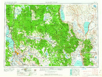
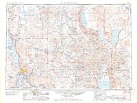
The Klamath Indian Reservation occupies a massive central portion of this Southern Oregon landscape, situated between the volcanic peaks of Crater Lake National Park and the high desert basins to the east. By the mid-1950s, a complex transportation network had matured here, defined by the Southern Pacific RR and Great Northern RR corridors that supported the region's timber and agricultural industries. High-altitude hydrology is a dominant theme, from the expansive Upper Klamath Lake and Agency Lake in the west to the terminal alkaline waters of Summer Lake and Lake Abert in the east.
Find a feature on this map
52 named features on this map. Tap any name to fly to it.
Don’t see what you’re looking for? This feature index may not catch every label — zoom into the map to look around manually.
Map Details
Editions of this 1958 Klamath Falls Map
3 editions found
Other maps of this area

1886 · Alturas
USGS Topo · 1:250,000

1886 · Modoc Lava Bed
USGS Topo · 1:250,000

1886 · Shasta
USGS Topo · 1:250,000

1889 · Klamath
USGS Topo · 1:250,000

1889 · Long Valley
USGS Topo · 1:250,000

1891 · Ashland
USGS Topo · 1:250,000

1892 · Modoc Lava-Bed
USGS Topo · 1:250,000

1892 · Alturas
USGS Topo · 1:250,000

1893 · Ashland
USGS Topo · 1:250,000

1894 · Klamath
USGS Topo · 1:250,000