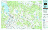
1991 Map of Klamath Falls
USGS Topo · Published 1992About this map
Upper Klamath Lake and the complex hydrology of the Lost River Valley dominate this regional survey, capturing the agricultural and timber landscapes of Southern Oregon as they appeared in the early 1990s. The city of Klamath Falls serves as the central hub, where the Southern Pacific and Burlington Northern railroads converge near the industrial footprints of Pelican City and the expanding residential grid of Altamont. The map illustrates a highly managed landscape, from the reclamation projects of the Lower Klamath National Wildlife Refuge to the irrigation networks supporting towns like Merrill and Malin near the California state line.
Find a feature on this map
72 named features on this map. Tap any name to fly to it.
Don’t see what you’re looking for? This feature index may not catch every label — zoom into the map to look around manually.
Map Details
Editions of this 1991 Klamath Falls Map
This is the sole edition of this map. No revisions or reprints were ever made.
Other maps of this area

1886 · Alturas
USGS Topo · 1:250,000

1886 · Modoc Lava Bed
USGS Topo · 1:250,000

1886 · Shasta
USGS Topo · 1:250,000

1889 · Klamath
USGS Topo · 1:250,000

1891 · Ashland
USGS Topo · 1:250,000

1892 · Modoc Lava-Bed
USGS Topo · 1:250,000

1892 · Alturas
USGS Topo · 1:250,000

1893 · Ashland
USGS Topo · 1:250,000

1894 · Klamath
USGS Topo · 1:250,000

1894 · Shasta
USGS Topo · 1:250,000