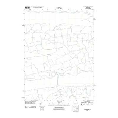
2010 Map of Klingerstown
USGS Topo · Published 2010About this map
Mahantango Creek and Mahanoy Creek frame a landscape of narrow valleys and winding watercourses in this portion of central Pennsylvania. The terrain is defined by a dense network of local roads that follow the contours of the land, connecting rural homesteads and agricultural tracts. Schadels Airport serves as a distinct landmark in the central valley, situated near the meandering path of Mahantango Creek.
Find a feature on this map
65 named features on this map. Tap any name to fly to it.
Don’t see what you’re looking for? This feature index may not catch every label — zoom into the map to look around manually.
Map Details
Editions of this 2010 Klingerstown Map
This is the sole edition of this map. No revisions or reprints were ever made.
Other maps of this area

1892 · Lykens
USGS Topo · 1:62,500

1892 · Shamokin
USGS Topo · 1:62,500

1893 · Sunbury
USGS Topo · 1:62,500

1893 · Lykens
USGS Topo · 1:62,500

1893 · Shamokin
USGS Topo · 1:62,500

1893 · Millersburg
USGS Topo · 1:62,500

1943 · Millersburg
USGS Topo · 1:62,500

1943 · Lykens
USGS Topo · 1:62,500

1943 · Shamokin
USGS Topo · 1:62,500

1943 · Sunbury
USGS Topo · 1:62,500
Featured Places
- West Cameron Township, PA
- Hubley Township, PA
- Rough and Ready, Upper Mahantango Township
- Greenbrier, Washington Township
- Fearnot, Hubley Township