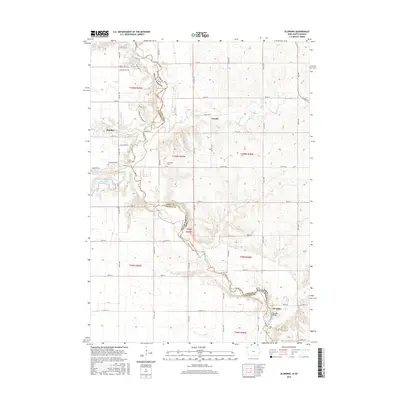
2015 Map of Klondike
USGS Topo · Published 2015About this map
The Big Sioux River carves a winding path along the state boundary of South Dakota and Iowa, defining the border between Lyon County and Lincoln County. This rural landscape is anchored by the small settlements of Klondike, Granite, and Shindler, reflecting a quiet agricultural economy structured by a dense grid of range lines and section roads. The river valley is a focal point for the region's topography, where the Klondike Bridge spans the water near the mouth of Klondike Creek. Further north, Blood Run meanders toward the larger river, passing just south of Granite. Genealogists may find interest in the centrally located Grandview Cemetery, while the western edge of the map features Lake Alvin, a notable water body fed by Ninernile Creek. The terrain is characterized by gentle slopes rising from the river bottoms, with several smaller tributaries like Spring Creek feeding into the primary drainage system.
Find a feature on this map
43 named features on this map. Tap any name to fly to it.
Don’t see what you’re looking for? This feature index may not catch every label — zoom into the map to look around manually.
Map Details
Editions of this 2015 Klondike Map
This is the sole edition of this map. No revisions or reprints were ever made.
Other maps of this area

1897 · Canton
USGS Topo · 1:125,000

1900 · Canton
USGS Topo · 1:125,000

1955 · Sioux Falls
USGS Topo · 1:250,000

1958 · Sioux Falls
USGS Topo · 1:250,000

1962 · Klondike
USGS Topo · 1:24,000

1962 · Harrisburg
USGS Topo · 1:24,000

1962 · Canton
USGS Topo · 1:24,000

1962 · Brandon
USGS Topo · 1:24,000

1962 · Sioux Falls East
USGS Topo · 1:24,000

1964 · Canton SW
USGS Topo · 1:24,000