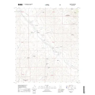
2018 Map of Klondyke
USGS Topo · Published 2018About this map
Klondyke serves as the focal point of this arid Arizona landscape, situated along the corridor of Klondyke Rd and the Araivaipa Cr. The topography is defined by sharp elevation shifts between the Santa Teresa Mountains to the north and the expansive Coronado National Forest lands to the south. Local water sources are vital markers in this terrain, identified by features like Haby Spring, Quartz Hill Spring, and a variety of tanks such as Teresa Tank and Little Wonder Tank.
Find a feature on this map
46 named features on this map. Tap any name to fly to it.
Don’t see what you’re looking for? This feature index may not catch every label — zoom into the map to look around manually.
Map Details
Editions of this 2018 Klondyke Map
This is the sole edition of this map. No revisions or reprints were ever made.
Other maps of this area

1938 · Galiuro Mts
USGS Topo · 1:48,000

1938 · Klondyke
USGS Topo · 1:48,000

1940 · Sierra Bonita Ranch
USGS Topo · 1:62,500

1942 · Sierra Bonita Ranch
USGS Topo · 1:62,500

1943 · Galiuro Mts
USGS Topo · 1:62,500

1943 · Klondyke
USGS Topo · 1:62,500

1943 · Sierra Bonita Ranch
USGS Topo · 1:62,500

1944 · Jackson Mtn.
USGS Topo · 1:62,500

1946 · Jackson Mtn.
USGS Topo · 1:62,500

1956 · Tucson
USGS Topo · 1:250,000