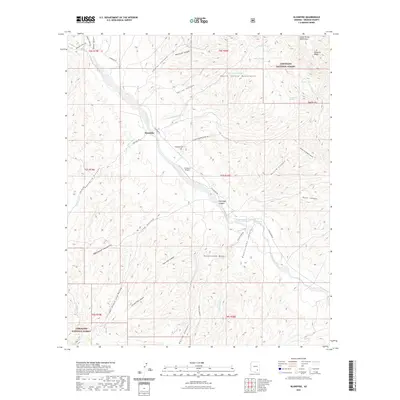
2021 Map of Klondyke
USGS Topo · Published 2021About this map
Klondyke serves as the primary hub in this arid landscape of southeast Arizona, situated near the intersection of Klondyke Rd and Flying Diamond Ranch Rd. The settlement is closely tied to the geography of Klondyke Wash and Aravaipa Cr, which carve through the high-elevation terrain. This modern survey illustrates a rugged ranching and conservation environment, anchored by the Coronado National Forest and the dramatic topography of Aravaipa Canyon.
Find a feature on this map
47 named features on this map. Tap any name to fly to it.
Don’t see what you’re looking for? This feature index may not catch every label — zoom into the map to look around manually.
Map Details
Editions of this 2021 Klondyke Map
This is the sole edition of this map. No revisions or reprints were ever made.
Other maps of this area

1938 · Galiuro Mts
USGS Topo · 1:48,000

1938 · Klondyke
USGS Topo · 1:48,000

1940 · Sierra Bonita Ranch
USGS Topo · 1:62,500

1942 · Sierra Bonita Ranch
USGS Topo · 1:62,500

1943 · Galiuro Mts
USGS Topo · 1:62,500

1943 · Klondyke
USGS Topo · 1:62,500

1943 · Sierra Bonita Ranch
USGS Topo · 1:62,500

1944 · Jackson Mtn.
USGS Topo · 1:62,500

1946 · Jackson Mtn.
USGS Topo · 1:62,500

1956 · Tucson
USGS Topo · 1:250,000