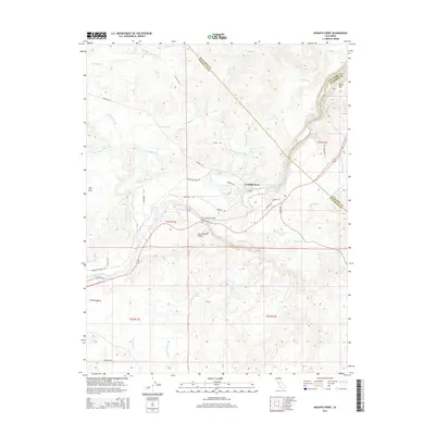
2015 Map of Knights Ferry
USGS Topo · Published 2015About this map
The Knights Ferry settlement sits at a critical transition point where the Stanislaus River emerges from the Sierra Nevada foothills into the San Joaquin Valley. This landscape is defined by its complex water management infrastructure, including the San Joaquin Main Canal, Thalheim Lateral, and the Cape Horn Tunnel. These man-made features weave through a terrain marked by distinctive geological formations like Table Mtn and Lovers Leap.
Find a feature on this map
45 named features on this map. Tap any name to fly to it.
Don’t see what you’re looking for? This feature index may not catch every label — zoom into the map to look around manually.
Map Details
Editions of this 2015 Knights Ferry Map
This is the sole edition of this map. No revisions or reprints were ever made.
Other maps of this area

1915 · Oakdale
USGS Topo · 1:31,680

1915 · Paulsell
USGS Topo · 1:31,680

1916 · Cooperstown
USGS Topo · 1:31,680

1916 · Waterford
USGS Topo · 1:31,680

1916 · Bachelor Valley
USGS Topo · 1:31,680

1916 · Copperopolis
USGS Topo · 1:62,500

1939 · Modesto East
USGS Topo · 1:62,500

1942 · Farmington
USGS Topo · 1:62,500
1942 · Modesto East
USGS Topo · 1:62,500

1942 · Copperopolis
USGS Topo · 1:62,500