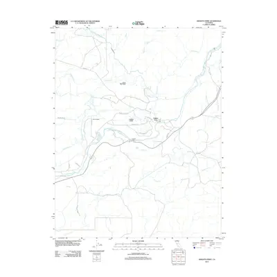
2021 Map of Knights Ferry
USGS Topo · Published 2021About this map
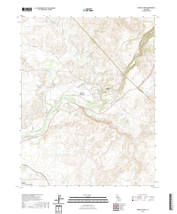
The Stanislaus River defines this landscape, winding through a complex topography where the foothills of the Sierra Nevada meet the eastern edge of the San Joaquin Valley. The historic river crossing at Knights Ferry serves as a focal point, surrounded by a network of water management features that tell the story of the region's agricultural development. Canals and laterals, including the San Joaquin Main Canal, Thalheim Lateral, and Paulsell Lateral, distribute water across the varied terrain. Local history is anchored by landmarks such as the Oak Grove Cem and the distinctive formation known as Lovers Leap. The map also captures the settlement at Orange Blossom and the intricate creek systems of Wildcat Cr and Cashman Creek that feed into the river valley.
Find a feature on this map
45 named features on this map. Tap any name to fly to it.
Don’t see what you’re looking for? This feature index may not catch every label — zoom into the map to look around manually.
Map Details
Editions of this 2021 Knights Ferry Map
This is the sole edition of this map. No revisions or reprints were ever made.
Historical Maps of Knights Ferry Through Time
5 maps found