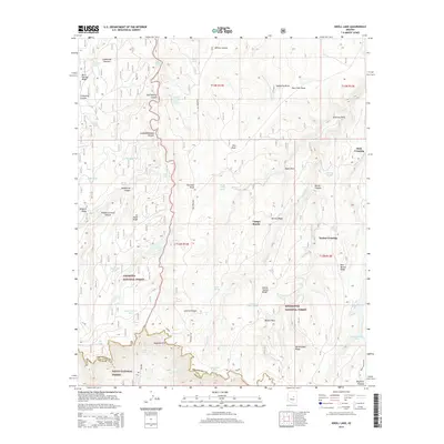
2014 Map of Knoll Lake
USGS Topo · Published 2014About this map
The Mogollon Rim escarpment marks a dramatic geological boundary on this survey, separating the Mogollon Plateau from the descending canyons of the Tonto National Forest. This high-altitude landscape is defined by its complex drainage systems, where Turkey Cr and Leonard Canyon carve through the terrain. Significant water resources like Knoll Lake and Bear Canyon Lake are centerpiece features, surrounded by a network of smaller tanks and springs such as Double Cabin Spring and Whiskey Springs that supported both wildlife and livestock in this forest environment.
Find a feature on this map
59 named features on this map. Tap any name to fly to it.
Don’t see what you’re looking for? This feature index may not catch every label — zoom into the map to look around manually.
Map Details
Editions of this 2014 Knoll Lake Map
This is the sole edition of this map. No revisions or reprints were ever made.
Other maps of this area

1886 · Holbrook
USGS Topo · 1:250,000

1887 · Verde
USGS Topo · 1:250,000

1892 · Verde
USGS Topo · 1:250,000

1893 · Holbrook
USGS Topo · 1:250,000

1934 · Promontory Butte
USGS Topo · 1:62,500

1939 · Promontory Butte
USGS Topo · 1:62,500

1952 · Promontory Butte
USGS Topo · 1:62,500

1954 · Holbrook
USGS Topo · 1:250,000

1957 · Holbrook
USGS Topo · 1:250,000

1958 · Holbrook
USGS Topo · 1:250,000