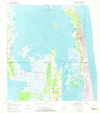
1954 Map of Knotts Island
USGS Topo · Published 1972About this map
Knotts Island anchors this coastal landscape where the border between Virginia and North Carolina cuts through the marshy expanse of Knotts Island Bay. The map reveals an intricate network of waterways and low-lying landforms, from the open waters of Back Bay to the protective barrier of False Cape along the Atlantic Ocean. The presence of the Back Bay National Wildlife Refuge underscores the importance of this ecosystem, which is characterized by a labyrinth of islands like Big Ball Island and Deal Island separated by narrow channels such as Porpoise Slough.
Find a feature on this map
51 named features on this map. Tap any name to fly to it.
Don’t see what you’re looking for? This feature index may not catch every label — zoom into the map to look around manually.
Map Details
Editions of this 1954 Knotts Island Map
3 editions found
Other maps of this area

1893 · Virginia Beach
USGS Topo · 1:125,000

1916 · Back Bay
USGS Topo · 1:62,500

1939 · Moyock
USGS Topo · 1:62,500

1940 · Barco
USGS Topo · 1:62,500

1943 · Back Bay
USGS Topo · 1:62,500

1946 · Moyock
USGS Topo · 1:62,500

1946 · Eastville
USGS Topo · 1:250,000

1946 · Currituck Sound
USGS Topo · 1:250,000

1948 · Elizabeth City
USGS Topo · 1:62,500

1953 · Norfolk
USGS Topo · 1:250,000