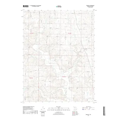
2017 Map of Knoxville
USGS Topo · Published 2017About this map
Knoxville sits at the intersection of several regional routes in this rural Ray County landscape, where the drainage patterns of the Crooked River and its numerous tributaries dictate the placement of roads and farmsteads. The terrain is deeply carved by small waterways such as Cockerel Cr, Coon Br, and Fire Br, creating a network of ridges and hollows that define local boundaries. For genealogists and local historians, the sheet preserves the locations of several family-named burial grounds, including Sandals Cem, Mayes Cem, and Maddux Cem. These small cemeteries are often the last standing indicators of early settlement clusters in a region largely dominated by agriculture and natural stream forks like Rocky Fork and McDonald Br. The road network, including State Hwy D and State Hwy HH, follows these ancient topographical lines, connecting the scattered homesteads to the village center.
Find a feature on this map
69 named features on this map. Tap any name to fly to it.
Don’t see what you’re looking for? This feature index may not catch every label — zoom into the map to look around manually.
Map Details
Editions of this 2017 Knoxville Map
This is the sole edition of this map. No revisions or reprints were ever made.
Other maps of this area

1889 · Lexington
USGS Topo · 1:125,000

1894 · Independence
USGS Topo · 1:125,000

1924 · Polo
USGS Topo · 1:62,500

1924 · Braymer
USGS Topo · 1:62,500

1950 · Kansas City
USGS Topo · 1:250,000

1953 · Moberly
USGS Topo · 1:250,000

1954 · Kansas City
USGS Topo · 1:250,000

1954 · Moberly
USGS Topo · 1:250,000

1956 · Kansas City
USGS Topo · 1:250,000

1957 · Moberly
USGS Topo · 1:250,000