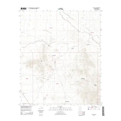
2014 Map of Ko Vaya
USGS Topo · Published 2014About this map
Santa Lucia and the surrounding Sonoran landscape are defined by a network of seasonal watercourses and scattered settlements within the Tohono O'odham Nation. This high-desert region is anchored by the Ko Vaya Hills and the prominent Picacho Peak, which rise above the surrounding flats. The map reveals a cluster of distinct local communities including Nolic, Rincon, and Santa Cruz (Koson Vaya), often situated near essential drainage features like the San Luis Wash. Bureau of Indian Affairs routes, such as Bia-232 and Bia-30, serve as the primary conduits through the basin, connecting these outposts across the Gu Oldak Valley. To the southeast, the terrain climbs into the South Comobabi Mountains, illustrating the dramatic shift from valley floors to isolated desert ranges that dictate the placement of roads and homesteads in this part of Pima County.
Find a feature on this map
22 named features on this map. Tap any name to fly to it.
Don’t see what you’re looking for? This feature index may not catch every label — zoom into the map to look around manually.
Map Details
Editions of this 2014 Ko Vaya Map
This is the sole edition of this map. No revisions or reprints were ever made.
Other maps of this area

1934 · Silver Bell
USGS Topo · 1:125,000

1937 · Comobabi
USGS Topo · 1:48,000

1941 · Sells
USGS Topo · 1:62,500

1942 · Comobabi
USGS Topo · 1:62,500

1943 · Sells
USGS Topo · 1:62,500

1943 · Fresnal
USGS Topo · 1:125,000

1953 · Ajo
USGS Topo · 1:250,000

1954 · Sonoyta
USGS Topo · 1:250,000

1956 · Nogales
USGS Topo · 1:250,000

1956 · Tucson
USGS Topo · 1:250,000