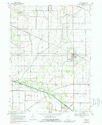
1969 Map of Kouts
USGS Topo · Published 1989About this map
The town of Kouts serves as the primary hub of this northern Indiana landscape, where a dense network of drainage canals and railroads defines the local economy and geography. Three major rail lines—the Chesapeake and Ohio, Erie-Lackawanna, and Penn Central—intersect near the town, highlighting its historical importance as a transit junction. To the south, the Kankakee River forms the natural boundary between Porter and Jasper counties, its flow managed by a complex system of local ditches such as Morgan Ditch and Hook Ditch. Small rural centers like Aylesworth and Five Points Corner are visible alongside local markers like Merriman Cem and Spencer Cem, offering clear reference points for genealogists and local historians studying the mid-century agricultural patterns of Boone and Pleasant townships.
Find a feature on this map
34 named features on this map. Tap any name to fly to it.
Don’t see what you’re looking for? This feature index may not catch every label — zoom into the map to look around manually.
Map Details
Editions of this 1969 Kouts Map
2 editions found
Other maps of this area

1953 · Palmer
USGS Topo · 1:24,000

1953 · Wanatah
USGS Topo · 1:24,000

1953 · Hebron
USGS Topo · 1:24,000

1953 · Valparaiso
USGS Topo · 1:24,000

1953 · Kouts
USGS Topo · 1:24,000

1953 · Chicago
USGS Topo · 1:250,000

1957 · Chicago
USGS Topo · 1:250,000

1957 · Wheatfield
USGS Topo · 1:24,000

1957 · DeMotte
USGS Topo · 1:24,000

1958 · La Crosse
USGS Topo · 1:24,000