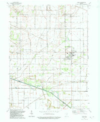
1992 Map of Kouts
USGS Topo · Published 1992About this map
The Kankakee River winds across this landscape south of Kouts, defining the boundary between Porter and Jasper counties. This 1992 revision reveals a region defined by an extensive drainage network, including the Sandy Hook Ditch and Brevogel Ditch, which supports the agricultural base of townships like Pleasant and Boone. The town of Kouts serves as the local center, with an interesting grid pattern and the presence of the Old Railroad Grade marking the path of former rail lines through the area.
Find a feature on this map
37 named features on this map. Tap any name to fly to it.
Don’t see what you’re looking for? This feature index may not catch every label — zoom into the map to look around manually.
Map Details
Editions of this 1992 Kouts Map
This is the sole edition of this map. No revisions or reprints were ever made.
Other maps of this area

1953 · Palmer
USGS Topo · 1:24,000

1953 · Wanatah
USGS Topo · 1:24,000

1953 · Hebron
USGS Topo · 1:24,000

1953 · Valparaiso
USGS Topo · 1:24,000

1953 · Kouts
USGS Topo · 1:24,000

1953 · Chicago
USGS Topo · 1:250,000

1957 · Chicago
USGS Topo · 1:250,000

1957 · Wheatfield
USGS Topo · 1:24,000

1957 · DeMotte
USGS Topo · 1:24,000

1958 · La Crosse
USGS Topo · 1:24,000