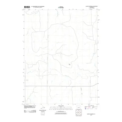
2010 Map of Kuhns Crossing
USGS Topo · Published 2010About this map
Kuhns Crossing serves as the focal point of this high plains landscape in Elbert County, where the dendritic drainage patterns of the Colorado prairie are clearly defined. The terrain is characterized by the winding path of East Bijou Creek, which is joined by several smaller tributaries including Reed Springs Creek and Bland Creek. This area, primarily organized by a grid of rural roads such as County Rd 125 and County Rd 117, highlights the intersection of natural watercourses and established ranching corridors. Distinctive landforms like Rocky Peak and the evocative Sixshooter Gulch provide navigational landmarks in an otherwise open expanse. The map illustrates how local geography is tied to the creek beds, which historically dictated movement and settlement patterns throughout this section of the state.
Find a feature on this map
11 named features on this map. Tap any name to fly to it.
Don’t see what you’re looking for? This feature index may not catch every label — zoom into the map to look around manually.
Map Details
Editions of this 2010 Kuhns Crossing Map
This is the sole edition of this map. No revisions or reprints were ever made.
Other maps of this area

1891 · Limon
USGS Topo · 1:125,000

1892 · Limon
USGS Topo · 1:125,000

1953 · Denver
USGS Topo · 1:250,000

1954 · Limon
USGS Topo · 1:250,000

1957 · Denver
USGS Topo · 1:250,000

1957 · Limon
USGS Topo · 1:250,000

1958 · Limon
USGS Topo · 1:250,000

1958 · Denver
USGS Topo · 1:250,000

1960 · Denver
USGS Topo · 1:250,000

1970 · Agate
USGS Topo · 1:24,000