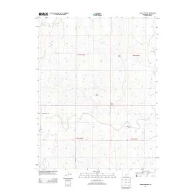
2013 Map of Kuhns Crossing
USGS Topo · Published 2013About this map
Kuhns Crossing sits at the heart of this high-plains landscape in Elbert County, where the terrain is defined by a network of seasonal drainages and subtle rises. The area is marked by distinctive topographical features such as Rocky Peak and the curiously named Sixshooter Gulch, alongside other local landmarks like Beuck Draw and Cattle Gulch. This 2013 survey illustrates the agricultural and aviation character of the region, featuring the Schantz Airstrip and a sparse network of rural routes including Co Road 141. The drainage patterns of Wilson Creek and Water Gulch indicate the typical arid hydrology of the Colorado plains, where water management and land use are closely tied to the natural contours of the draws and gulches.
Find a feature on this map
13 named features on this map. Tap any name to fly to it.
Don’t see what you’re looking for? This feature index may not catch every label — zoom into the map to look around manually.
Map Details
Editions of this 2013 Kuhns Crossing Map
This is the sole edition of this map. No revisions or reprints were ever made.
Other maps of this area

1891 · Limon
USGS Topo · 1:125,000

1892 · Limon
USGS Topo · 1:125,000

1953 · Denver
USGS Topo · 1:250,000

1954 · Limon
USGS Topo · 1:250,000

1957 · Denver
USGS Topo · 1:250,000

1957 · Limon
USGS Topo · 1:250,000

1958 · Limon
USGS Topo · 1:250,000

1958 · Denver
USGS Topo · 1:250,000

1960 · Denver
USGS Topo · 1:250,000

1970 · Agate
USGS Topo · 1:24,000