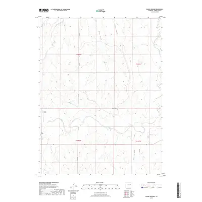
2019 Map of Kuhns Crossing
USGS Topo · Published 2019About this map
Kuhns Crossing anchors the western edge of this Elbert County landscape, where the high plains are carved by a network of seasonal drainages and named gulches. The terrain is defined by the winding course of E Bijou Cr, which meanders eastward toward the county line, joined by tributaries such as Reed Springs Cr and the descriptively named Sixshooter Gulch. This modern survey reveals a sparsely populated ranching and aviation environment, centered around landmarks like Rocky Peak and the private Schantz Airstrip. The grid of county roads, including Co RD 125 and Co RD 117, provides the primary framework for the scattered homesteads and agricultural operations that persist in this corner of the Colorado plains.
Find a feature on this map
20 named features on this map. Tap any name to fly to it.
Don’t see what you’re looking for? This feature index may not catch every label — zoom into the map to look around manually.
Map Details
Editions of this 2019 Kuhns Crossing Map
This is the sole edition of this map. No revisions or reprints were ever made.
Other maps of this area

1891 · Limon
USGS Topo · 1:125,000

1892 · Limon
USGS Topo · 1:125,000

1953 · Denver
USGS Topo · 1:250,000

1954 · Limon
USGS Topo · 1:250,000

1957 · Denver
USGS Topo · 1:250,000

1957 · Limon
USGS Topo · 1:250,000

1958 · Limon
USGS Topo · 1:250,000

1958 · Denver
USGS Topo · 1:250,000

1960 · Denver
USGS Topo · 1:250,000

1970 · Agate
USGS Topo · 1:24,000