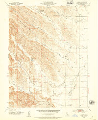
1952 Map of Kurand
USGS Topo · Published 1953About this map
Kurand sits at the eastern edge of a rugged transition between the Sacramento Valley and the Coast Range foothills, as seen in this 1952 remapping of a 1904 survey. The landscape is defined by the sharp contrast between the flatlands along the Southern Pacific Railroad Dismantled line and the deeply carved drainages of Stone Gulch and Salt Hollow. Water management is central to the area's utility, marked by numerous windmills, wells, and a small Reservoir with a spillway tucked into the hills.
Find a feature on this map
23 named features on this map. Tap any name to fly to it.
Don’t see what you’re looking for? This feature index may not catch every label — zoom into the map to look around manually.
Map Details
Editions of this 1952 Kurand Map
4 editions found
Other maps of this area

1904 · Walker Creek
USGS Topo · 1:31,680

1904 · Logan Creek
USGS Topo · 1:24,000

1906 · Maxwell
USGS Topo · 1:62,500

1906 · Willows
USGS Topo · 1:62,500

1914 · Orland
USGS Topo · 1:31,680

1917 · Kurand
USGS Topo · 1:31,680

1917 · Lyman
USGS Topo · 1:31,680

1917 · Logandale
USGS Topo · 1:31,680

1918 · Logan Creek
USGS Topo · 1:31,680

1919 · Fruto
USGS Topo · 1:62,500