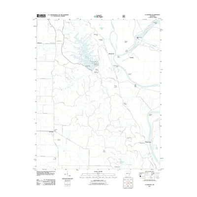
2011 Map of La Grange
USGS Topo · Published 2011About this map
La Grange stands near the intersection of Wire Rd and State Hwy 44, anchoring a landscape defined by the convergence of the L'Anguille River and the Saint Francis River. This Arkansas delta region shows a complex network of bayous and oxbows, including Phillips Bayou and Anderson Lake, illustrating the shifting path of these waterways over time. The eastern edge of the map follows the meandering river bends, notably Jeffersonville Bend and High Bank Bend, where the land yields to water at High Banks Landing.
Find a feature on this map
77 named features on this map. Tap any name to fly to it.
Don’t see what you’re looking for? This feature index may not catch every label — zoom into the map to look around manually.
Map Details
Editions of this 2011 La Grange Map
This is the sole edition of this map. No revisions or reprints were ever made.
Other maps of this area

1939 · Park Place
USGS Topo · 1:62,500

1939 · Latour
USGS Topo · 1:62,500

1940 · Marvell
USGS Topo · 1:62,500

1940 · Marianna
USGS Topo · 1:62,500

1948 · Helena
USGS Topo · 1:250,000

1950 · Helena
USGS Topo · 1:250,000

1955 · Park Place
USGS Topo · 1:62,500

1955 · Latour
USGS Topo · 1:62,500

1955 · Helena
USGS Topo · 1:250,000

1956 · Marvell
USGS Topo · 1:62,500