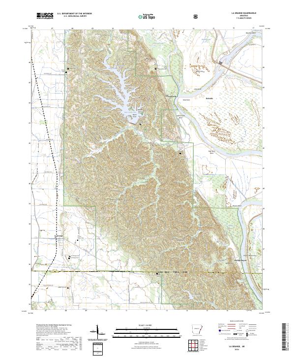
2024 Map of La Grange
USGS Topo · Published 2024About this map
Crowleys Ridge dominates this Arkansas landscape, where the elevation of the ridge meets the low-lying wetlands of the Mississippi Alluvial Plain. The map documents the community of La Grange at the intersection of State Hwy 185 and Lick Creek, alongside several smaller rural settlements like Jeffersonville and Haleside. These areas are characterized by a dense concentration of family and community burial grounds, including Lackie Cem, Mount Perion Cem, and Honor Hill Cem, which provide valuable location data for genealogists tracking local history.
Find a feature on this map
95 named features on this map. Tap any name to fly to it.
Don’t see what you’re looking for? This feature index may not catch every label — zoom into the map to look around manually.
Map Details
Editions of this 2024 La Grange Map
This is the sole edition of this map. No revisions or reprints were ever made.
Other maps of this area

1939 · Park Place
USGS Topo · 1:62,500

1939 · Latour
USGS Topo · 1:62,500

1940 · Marvell
USGS Topo · 1:62,500

1940 · Marianna
USGS Topo · 1:62,500

1948 · Helena
USGS Topo · 1:250,000

1950 · Helena
USGS Topo · 1:250,000

1955 · Park Place
USGS Topo · 1:62,500

1955 · Latour
USGS Topo · 1:62,500

1955 · Helena
USGS Topo · 1:250,000

1956 · Marvell
USGS Topo · 1:62,500