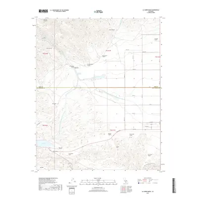
2018 Map of La Liebre Ranch
USGS Topo · Published 2018About this map
La Liebre Ranch and the surrounding high-altitude terrain sit at a complex intersection of water management and geology along the Kern and Los Angeles County line. The massive infrastructure of the Governor Edmund G Brown California Aqueduct dominates the landscape, including its East and West branches and the Tehachapi Afterbay. This system facilitates water movement through the mountains via the Carley V Porter Tunnel and South Portal Number Four, revealing the scale of mid-century engineering required to sustain Southern California's growth.
Find a feature on this map
50 named features on this map. Tap any name to fly to it.
Don’t see what you’re looking for? This feature index may not catch every label — zoom into the map to look around manually.
Map Details
Editions of this 2018 La Liebre Ranch Map
This is the sole edition of this map. No revisions or reprints were ever made.
Other maps of this area

1903 · Tejon
USGS Topo · 1:125,000

1932 · Neenach
USGS Topo · 1:24,000

1933 · Quail
USGS Topo · 1:24,000

1938 · Liebre
USGS Topo · 1:24,000

1938 · Quail
USGS Topo · 1:24,000

1943 · Neenach
USGS Topo · 1:62,500
1945 · Pastoria Creek
USGS Topo · 1:31,680
1945 · Lebec
USGS Topo · 1:31,680
1945 · Black Mtn
USGS Topo · 1:31,680

1949 · Los Angeles
USGS Topo · 1:250,000