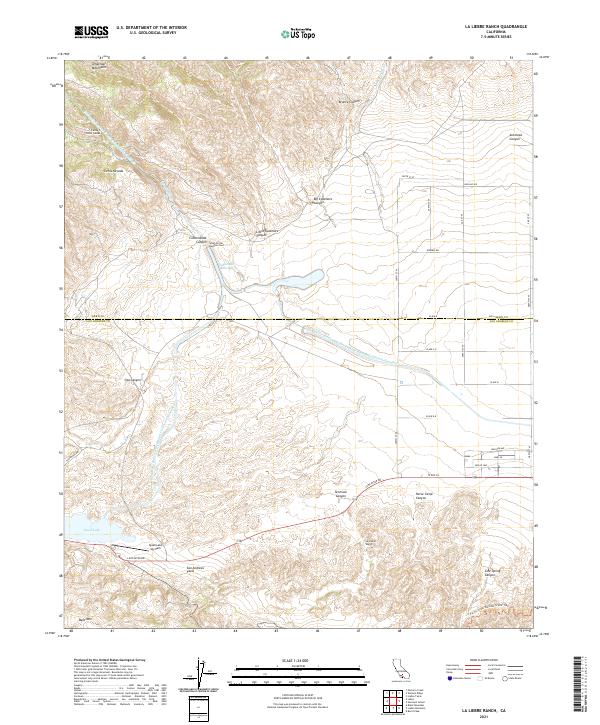
2021 Map of La Liebre Ranch
USGS Topo · Published 2021About this map
The San Andreas Fault cuts a diagonal path across this modern landscape at the boundary of the Tehachapi Mountains and the Sierra Nevada. This topographic study reveals a complex network of water infrastructure, dominated by the Governor Edmund G Brown California Aqueduct and its various branches, including the Tehachapi Afterbay and the Carley V Porter Tunnel. The geography is defined by deep incisions such as Cottonwood Canyon and Oso Canyon, which drain toward the arid basins below. Significant recreational and transit corridors are visible, from the Quail Lake Sky Park near Quail Lake to the winding path of the Pacific Crest National Scenic Trail. Historically centered on the namesake La Liebre Ranch, the area maintains a sparse settlement pattern with local landmarks like Bald Mtn and South Portal Number Four marking the intersection of natural geology and large-scale engineering.
Find a feature on this map
70 named features on this map. Tap any name to fly to it.
Don’t see what you’re looking for? This feature index may not catch every label — zoom into the map to look around manually.
Map Details
Editions of this 2021 La Liebre Ranch Map
This is the sole edition of this map. No revisions or reprints were ever made.
Other maps of this area

1903 · Tejon
USGS Topo · 1:125,000

1932 · Neenach
USGS Topo · 1:24,000

1933 · Quail
USGS Topo · 1:24,000

1938 · Liebre
USGS Topo · 1:24,000

1938 · Quail
USGS Topo · 1:24,000

1943 · Neenach
USGS Topo · 1:62,500
1945 · Pastoria Creek
USGS Topo · 1:31,680
1945 · Lebec
USGS Topo · 1:31,680
1945 · Black Mtn
USGS Topo · 1:31,680

1949 · Los Angeles
USGS Topo · 1:250,000