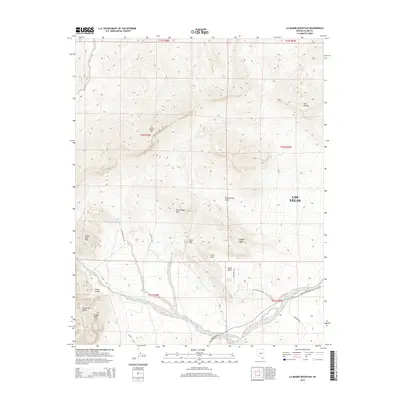
2015 Map of La Madre Mountain
USGS Topo · Published 2015About this map
La Madre Mtn dominates this desert landscape west of Las Vegas, anchoring a region of complex geology and vital water sources. This 2015 U.S. Geological Survey representation details a network of springs and canyons that have long served as essential landmarks in the arid terrain. Natural reliable water points like Willow Spring, Calico Spring, and Red Spring are interspersed between the high peaks of the White Rock Hills and the Calico Hills. The topographic detail highlights the sharp relief of features such as Icebox Canyon and the Sandstone Bluffs, while the presence of Red Rock Wash and Lost Lake suggests the seasonal flow patterns characteristic of the Mojave Desert. This sheet serves as a guide for understanding the relationship between the dramatic elevation of Turtlehead Mtn and the basins below, including Brownstone Basin and Calico Basin, which are accessed via routes like White Rock Trail Rd and Scenic Dr.
Find a feature on this map
31 named features on this map. Tap any name to fly to it.
Don’t see what you’re looking for? This feature index may not catch every label — zoom into the map to look around manually.
Map Details
Editions of this 2015 La Madre Mountain Map
This is the sole edition of this map. No revisions or reprints were ever made.
Other maps of this area

1907 · Las Vegas
USGS Topo · 1:250,000

1908 · Las Vegas
USGS Topo · 1:250,000

1952 · Corn Creek Springs
USGS Topo · 1:62,500

1952 · Blue Diamond
USGS Topo · 1:62,500

1954 · Las Vegas
USGS Topo · 1:250,000

1957 · Las Vegas
USGS Topo · 1:250,000

1957 · Charleston Peak
USGS Topo · 1:62,500

1957 · Mountain Springs
USGS Topo · 1:62,500

1959 · Las Vegas
USGS Topo · 1:250,000

1962 · Las Vegas
USGS Topo · 1:250,000