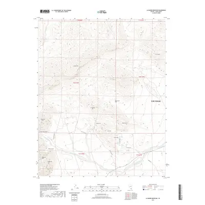
2018 Map of La Madre Mountain
USGS Topo · Published 2018About this map
Las Vegas encroaches from the east upon a dramatic desert landscape defined by the towering La Madre Mtn and the intricate folds of the Mojave Desert. This 2018 survey illustrates the geological complexity west of the city, where the Calico Hills and White Rock Hills meet deep recesses like Icebox Canyon and Lost Creek Canyon. The map details a network of vital water sources in this arid environment, including White Rock Spring, Willow Spring, and Red Spring. Settled pockets like Calico Basin are shown at the end of Calico Basin Rd, surrounded by distinctive landmarks such as Turtlehead Mtn and the striking Sandstone Bluffs. The map's high-relief data traces the dramatic drop-offs of Bridge Mtn and the winding path of the Red Rock Wash through the canyon floor.
Find a feature on this map
30 named features on this map. Tap any name to fly to it.
Don’t see what you’re looking for? This feature index may not catch every label — zoom into the map to look around manually.
Map Details
Editions of this 2018 La Madre Mountain Map
This is the sole edition of this map. No revisions or reprints were ever made.
Other maps of this area

1907 · Las Vegas
USGS Topo · 1:250,000

1908 · Las Vegas
USGS Topo · 1:250,000

1952 · Corn Creek Springs
USGS Topo · 1:62,500

1952 · Blue Diamond
USGS Topo · 1:62,500

1954 · Las Vegas
USGS Topo · 1:250,000

1957 · Las Vegas
USGS Topo · 1:250,000

1957 · Charleston Peak
USGS Topo · 1:62,500

1957 · Mountain Springs
USGS Topo · 1:62,500

1959 · Las Vegas
USGS Topo · 1:250,000

1962 · Las Vegas
USGS Topo · 1:250,000